When drones appeared on the scene en masse, many people saw the potential immediately—for military purposes, for breathtaking photography, even wildlife conservation, but for one small group of technicians, the AI-armed eye in the sky had another obvious purpose: saving people around the world from being killed by landmines and unexploded ordnance.
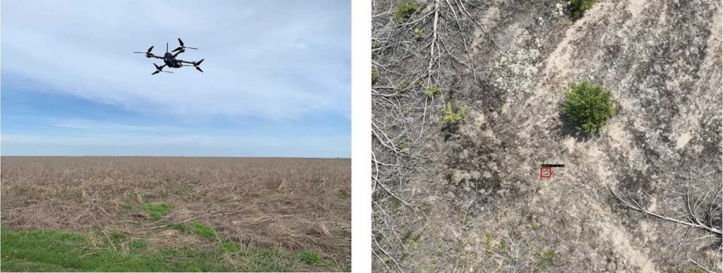
The group, called Safe Pro AI, pilots drones carrying patented advanced computer vision software technologies that sweeps the ground for landmines.
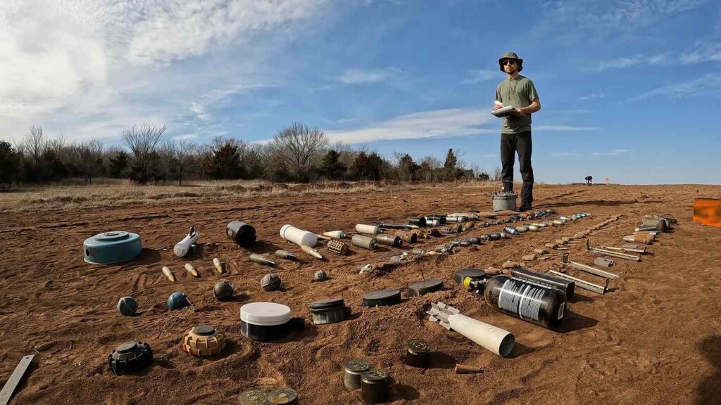
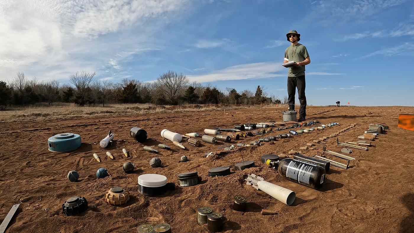
Recently, the team from Safe Pro was invited by the UN and Armed Forces of Ukraine to conduct training exercises in a field north of Kyiv. UN workers had scattered between 50 and 100 inert landmines and bombs in the field and told Jasper Baur and his colleagues to get to work.
Using flight planning software, Jasper and the co-founder on the project, Gabriel Steinberg pulled an all-nighter coding for the detection of all the mines in the more than 15,000 pictures the drones captured. It took 2 hours for the deep-learning algorithm to make it’s determinations from the photographs, in which it correctly located 72 of the hazards.
“[t]he UN deemed our results impressive enough to invite us back for a second round of demonstrations,” Baur writes in the most recent issue of Spectrum IEEE. “All our hard work paid off. Today, our technology is being used by several humanitarian nonprofits detecting land mines in Ukraine, including the Norwegian People’s Aid and the HALO Trust, which is the world’s largest nonprofit dedicated to clearing explosives left behind after wars.”
The sky is the limit for this kind of technology. Landmines and leftover shells and bombs contaminate over 50 nations and regions, from the obvious conflict zones of Afghanistan and Ukraine, to those of long forgotten conflicts (from the world’s perspective) like the Falklands War and Laos.

In 2020 alone, 146 square kilometers of land, nearly 4 million acres, were cleared of more than 135,000 antipersonnel mines, but thousands are killed and injured every year by devices now illegal under a UN treaty signed over 167 states. Despite this illegality, most warring nations still engage in the practice of mining, including both Russia and Ukraine, and the United States when it shipped cluster bombs manufactured in 1990 to help Ukraine’s war effort.
Because of this shortfall in international law enforcement, organizations like Safe Pro AI are imperative to keep the world, particularly children and rural folk, from stepping on them.
OTHER POSITIVE STORIES OUT OF CONFLICTS: ARK Becomes ‘Life Raft’ Saving Over 15,000 Animals from Ukraine With Rescue Partners in Germany
An area the size of Florida is now mined in Ukraine, and it takes around 60,000 drone photos to cover a square kilometer, and 3 minutes for a human to check each drone photograph.
“At that rate, it would take more than 500 million person-hours to manually search imagery covering all of Ukraine’s suspected contaminated land,” Baur writes.
The start of Safe Pro AI came in 2019 after Baur and some colleagues at Binghamton University’s Geophysics and Remote Sensing Laboratory where he trained an AI system to detect a single kind of Soviet landmine known as a “butterfly mine” because of its shape.
MORE HUMANITARIAN TECH: Heavy-Lift Drone Can Haul 220-Pounds of Cargo for Delivery, Aid, or Construction Companies
In 2020 Steinberg and Baur founded the Demining Research Community, to focus on combating this explosive pandemic through robotics, geophysics, and remote sensing.
Last year, the Demining Research Community experimented by putting aerial magnetometry, thermal imaging, and LiDAR on their drones as well, which can help provide context for any visual images that the AI can’t make a good determination on.
SHARE This Lifesaving Use Of Drones And AI With Your Friends…


