


")


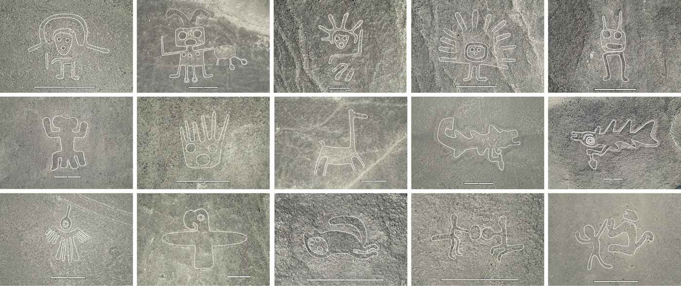
It took nearly a century to locate the 430 geoglyphs hidden in the Nazca Desert of Peru, but archaeologists surveying almost the entire region with the help of AI just turned up another 303 in a single study period.
Nazca is one of the greatest mysteries in anthropology—why did the Nazca Culture, active perhaps around the first century BCE, take the time to carve, dig, and arrange the Earth into these massive motifs of animals and human figures all over the desert?
The mystery has now deepened considerably.
The artificial intelligence used by the research team, consisting of scientists and archaeologists from Japan, France, Germany, and New York, was poorly trained, the team said, because of the limited number of subjects for it to study.
AI programs trained to identify tumors in X-ray images or mammograms, for example, are trained using thousands of positive cases. In stark contrast, there were only 430 Nazca lines for it to study.
So when the team deployed their AI to examine photographs of the Nazca Pampas taken from airplane, it went ballistic—identifying 47,000 possible matches. The team eventually cut that number down to 1,309 high-potential candidates.
Between September 2022 and February 2023, the team visited as many of the high-potential sites as possible to see whether a geoglyph was there. Aided by drones, they eventually narrowed down the 1,309 to 303.
“Of the 303 newly discovered figurative geoglyphs, 178 were suggested by the model, and 125 were additional finds. Of those, 66 were found as part of an AI-discovered cluster of geoglyphs, while 59 were discovered during the fieldwork without any help from AI,” CNN reports.
There’s no leading theory in why the Nazca Culture carved or dug out the lines on the ground, which have been well preserved in their unique, dry ecosystem prohibitive to agriculture, and remain visible at least 2,000 years after they were carved. Ideas suppose they are some form of calendar, that they were a pilgrimage site that got out of hand, or that they played some role in communication, dancing, and ceremony.
AI IN ARCHAEOLOGY: AI Used With Cold War Spy Satellites Can Detect Ancient Underground Aqueducts
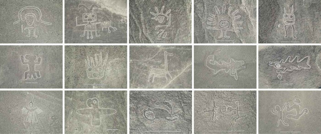
In the study of the figurative Nazca geoglyphs, the symbols are designated as either a line-type or relief-type geoglyph. Among the most famous line-type examples is the hummingbird, but more than half of the newly identified geoglyphs are relief-type, which more often depict humans, and without the beautiful geometry of the line-type glyphs.
The addition of 303 data points has allowed the study team to more broadly define the style and nature of the geoglyphs. For example, out of the more than 700 known, the line-type geoglyphs are almost all huge. Often utilizing straight lines and U-turns, they average around 90 meters—about 300 feet, in size.
ANCIENT MYSTERIES: 13,000 Years Ago, These Ancient Builders Carved a Calendar into Stone to Mark Destructive Occasion
By contrast, the relief-type geoglyphs, which are often stylized humans, heads, domesticated animals, or things modified/used by humans, average about one-tenth of the size of the line types.
The authors propose that the explanation of what these decorations were for involves how locals traveled across the area.
The figurative, relief-style geoglyphs are arranged often together, and often within sight of hundreds of miles of winding, well-worn footpaths. Using aerial imagery, the team determined that these winding trails had no fixed beginning or end, and were simply a result of continual use. Averaging 30 feet or so in length, these glyphs could be clearly seen by a person even at ground level.
By contrast, the line-type geoglyphs are massive and can only be seen in their entirety from the air. Their margins sat dozens or even hundreds of yards from a network of straight ‘roads’ that could be 120 feet wide at times.
BEFORE YOU GO: How a Chatty Motorist Led to One of the Biggest Finds in Greek Archaeology–the Lost 2,800-year-old Temple of Artemis
These roads ran in straight lines and in trapezoidal arrangements, and passed by each of the largest line-type geoglyphs on the northern boundary of the Nazca Pampas, with their other ends terminating at Cahauchi Temple and the confluence of the Tierras Blancas and Aja rivers.
“This indicates that the network was mainly designed for groups from the Ingenio River Valley to make pilgrimages to the Cahuachi Temple and the confluence of rivers in the Nazca River Valley,” the authors write in their study.
SHARE This News With Your Friends Who Love An Ancient Mystery Or Two…