
")


")


Spanish technical archaeologists have identified ancient irrigation ducts in desert regions around the world using AI.
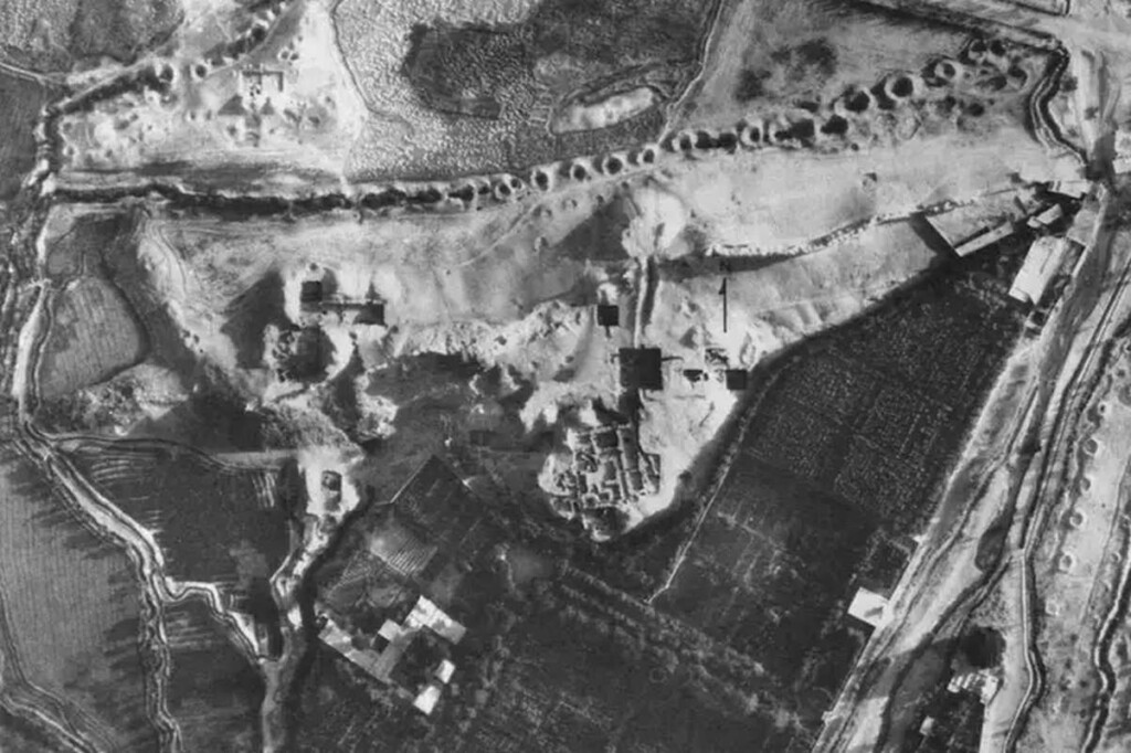
The AI was trained to pour through old spy satellite photos taken during the Cold War and look for evidence of underground aqueducts that carried water from highlands or mountains down into baking plains.
Unlike the iconic Roman above-ground aqueduct, these ‘qanats’ as they’re called, contained channels dug underground that were punctuated by a series of vertical shafts to allow airflow and maintenance. Being below ground prevented them from drying out in the desert sun.
A collection of qanats in Iran was included in a UNESCO World Heritage Site in 2016 that ensconced the Great Wall of Gorgon, and others are pending designation elsewhere. These fascinating innovations are found cross-culturally in North Africa, South America, China, and Central Asia.
The earliest qanats examined by the AI may have been dug 3,000 years ago, and unless one is standing right next to the access shafts, they are extremely difficult to locate and identify.
“These systems were extremely innovative,” Hector Orengo at the Catalan Institute of Classical Archaeology in Spain who led the study, told New Scientist. “They allowed people to live in areas where it would have been unthinkable before.”
US Cold War spy satellites photographed vast areas of the globe for the intelligence services, and Orengo et al. trained their AI to examine these for signs of qanats in the Middle East and North Africa taken between 1959 and 1986 by the HEXAGON satellite.
SATELLITE-BASED ARCHAEOLOGY: Spy Satellite Photos Reveal Hundreds of Long-Lost Roman Forts, Challenging Decades-Old Theory
The AI was trained on satellite pictures of qanats known to archaeologists, like those in Rissani, Morocco; Afghanistan’s Maiwand region, and the baking hot Gorgan plain in Iran.
The AI provided the team with guesses as to where a qanat may be located, and in 88% of these instances, it guessed correctly. Of these discoveries, the AI was able to identify the entire length of the qanat 62% of the time.
MORE AI NEWS: Drones Find Dozens of Landmines Littering Ukraine So They Can Be Defused
The newly-trained AI should be ready to examine photographs for undiscovered qanats across these regions—a method unquantifiably more efficient and safer than using human surveyors.
SHARE This Awesome Use Of AI With Your Friends Who Like History…